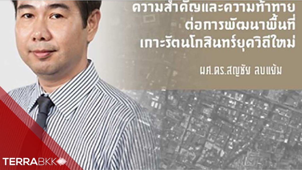
The Importance and Challenges of Developing the Rattanakosin Island Area in the New Normal Era
The Importance and Challenges of Developing the Rattanakosin Island Area in the New Normal Era
Rattanakosin Island is located between the Chao Phraya River to the west and the surrounding canals to the east, with the original city moat dividing it into inner and outer areas. The Rattanakosin Island covers an area of 4.10 square kilometers or 2,563 rai (Image 1). In terms of administrative boundaries, most of the area falls within the Phra Nakhon district, consisting of 9 sub-districts: 1) Phra Borom Maha Ratchawang, 2) Wang Burapha Phirom, 3) Wat Ratchabophit, 4) Samran Rat, 5) San Chao Pho Suea, 6) Sao Chingcha, 7) Chana Songkhram, 8) Talat Yot, and 9) Boworn Niwet.
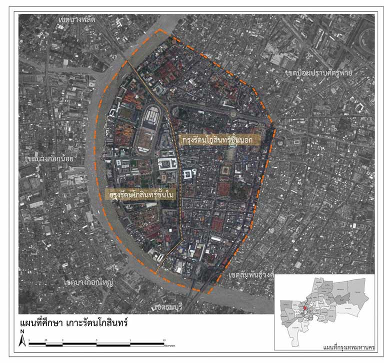
Image 1 Area of Rattanakosin Island
Rattanakosin Island is also home to many historic communities and important national sites, including: 1) 5 royal palaces, 2) 3 ministries: the Ministry of Interior, the Ministry of Defense, and the Ministry of Justice, 3) 6 departments, 4) religious sites of all faiths, more than 20 locations, including Wat Ratchabophit, the residence of the Supreme Patriarch, 5) 3 public universities: Silpakorn University, Thammasat University, and Rajamangala University of Technology Rattanakosin, 6) 9 important schools, and 7) 7 national museums (Images 2 & 3). In terms of transportation, Rattanakosin Island serves as a hub for 22 bus routes and boat transportation, including 8 ferry and express boat piers, with over 100,000 ferry passengers daily (comparable to MRT passengers) and more than 80,000 express boat passengers daily (comparable to Airport Rail Link passengers). According to the National Statistical Office's survey in 2016, the population in the area was approximately 36,500, with a continuous decline over the past decade. Additionally, household income compared to household expenses shows that many sub-districts face negative balances (expenses exceeding income). While the government is moving towards Industry 4.0 or new industries, surveys still indicate that the population in the Rattanakosin area primarily engages in wholesale, retail, and automotive and motorcycle repairs. Traffic congestion is another factor affecting the quality of life and the environment for residents and workers in the area. Statistics on vehicle speed during peak morning and evening hours from the Office of Transport and Traffic Policy and Planning (OTP) in 2016 averaged about 15 kilometers per hour. Given that Rattanakosin Island is crucial for traffic distribution between Thonburi and Phra Nakhon, combined with limited road space and bottlenecks at the three bridges crossing the Chao Phraya River—Somdet Phra Pin Klao Bridge, Phra Pok Klao Bridge, and Phra Buddha Yodfa Bridge—and limited parking space, while there are numerous international tourist attractions within the island, such as the Grand Palace, Wat Pho, Pak Khlong Talat, and Tha Tien, attracting over 6 million tourists annually, these factors together can lead to a crisis in transportation and environmental conditions in this area both in the short and long term.
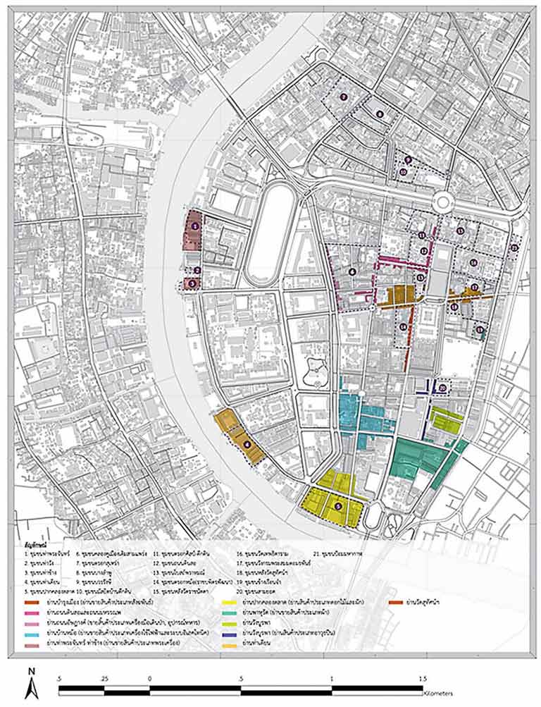
Image 2 Important Communities and Areas in Rattanakosin Island
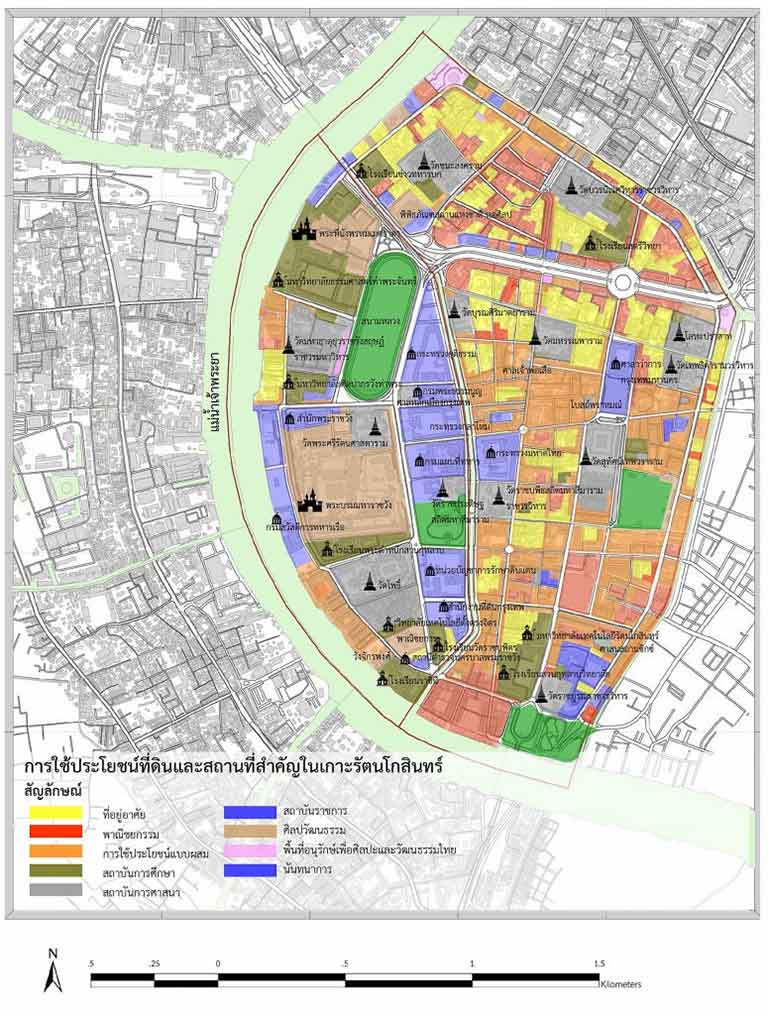
Image 3 Various Important Places and Land Use
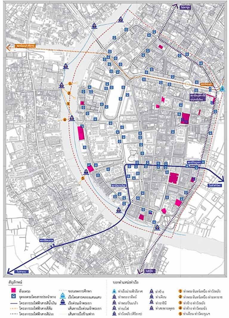
The government's infrastructure construction projects for transportation within Rattanakosin Island include significant projects such as the mass transit rail system (subway) with 3 lines: the Blue Line, the Orange Line, and the Purple Line, with 3 key stations in the area: Phan Fa Station, Wang Burapha Station, and Sanam Chai Station as shown in Image 4.
Image 4 Integrated Transportation System in Rattanakosin Island
The subway projects entering the Rattanakosin Island area are expected to be completed as follows: the Blue Line and Orange Line around 2020, and the Purple Line around 2024.
There are 5 factors that may pose obstacles or challenges to urban development in the new normal era: 1) the lack of foreign tourists, which is a significant income source for the tourism industry in the community, due to the prolonged COVID-19 pandemic, 2) the current Bangkok master plan (2013) designating Rattanakosin Island as a light brown zone, a conservation area to promote Thai cultural identity, 3) current building control laws, 4) Bangkok regulations prohibiting construction, modification, or change of use for certain types of buildings within the Rattanakosin Island area, and 5) the Prime Minister's Office regulations on the conservation and development of Rattanakosin and the old city from 2003, which may impact future development and investment in the Rattanakosin area. The trends over the past decade indicate a continuous decline in population, with residents moving out possibly due to unsuitable building use and land use for the new generation, and negative household income due to a lack of modern job opportunities that create added value in goods and services, or jobs and housing that do not meet the needs of the new generation. For these reasons, changes in building use, promoting mixed land use, encouraging green transportation systems, and allowing increased population density may be unavoidable to ensure that this city and community remain suitable for future generations.
Thank you for the article https://is.gd/VtLjSk
References
Bangkok Metropolitan Administration. (2013). Ministerial Regulation on the Implementation of the Bangkok Master Plan 2013. Royal Gazette.
Faculty of Architecture, Silpakorn University. (2018). Development of the Rattanakosin Innovation District.
Office of Transport and Traffic Policy and Planning, Ministry of Transport. (2016). Project Design Study
Details of Phahonyothin Transportation Center and Development Model for the Surrounding Area
Transport.
National Statistical Office. (2017). Annual Statistical Report Thailand 2017.

Author
Assistant Professor Dr.Sonchai Lobyaem
Department of Urban Design and Planning
Faculty of Architecture, Silpakorn University
Email [email protected]