How Can Your Real Estate Business Own the Best Locations? With ArcGIS
The Right Decision for Your Real Estate
ArcGIS for Land and Property Management
A Geospatial Platform for Real Estate Management: A New Tool for Developers in the Era of Digital Transformation
How Can Your Real Estate Business Own the Best Locations
ArcGIS is a globally recognized geospatial platform, renowned for its Location Intelligence, which creates insights through data analysis from new perspectives. This Location Intelligence encompasses processes from data collection, storage, sharing, analysis, to real-time access and integration, which are crucial for business decision-making, whether for problem-solving, efficient operations, or strategic business decisions.
Land Management System
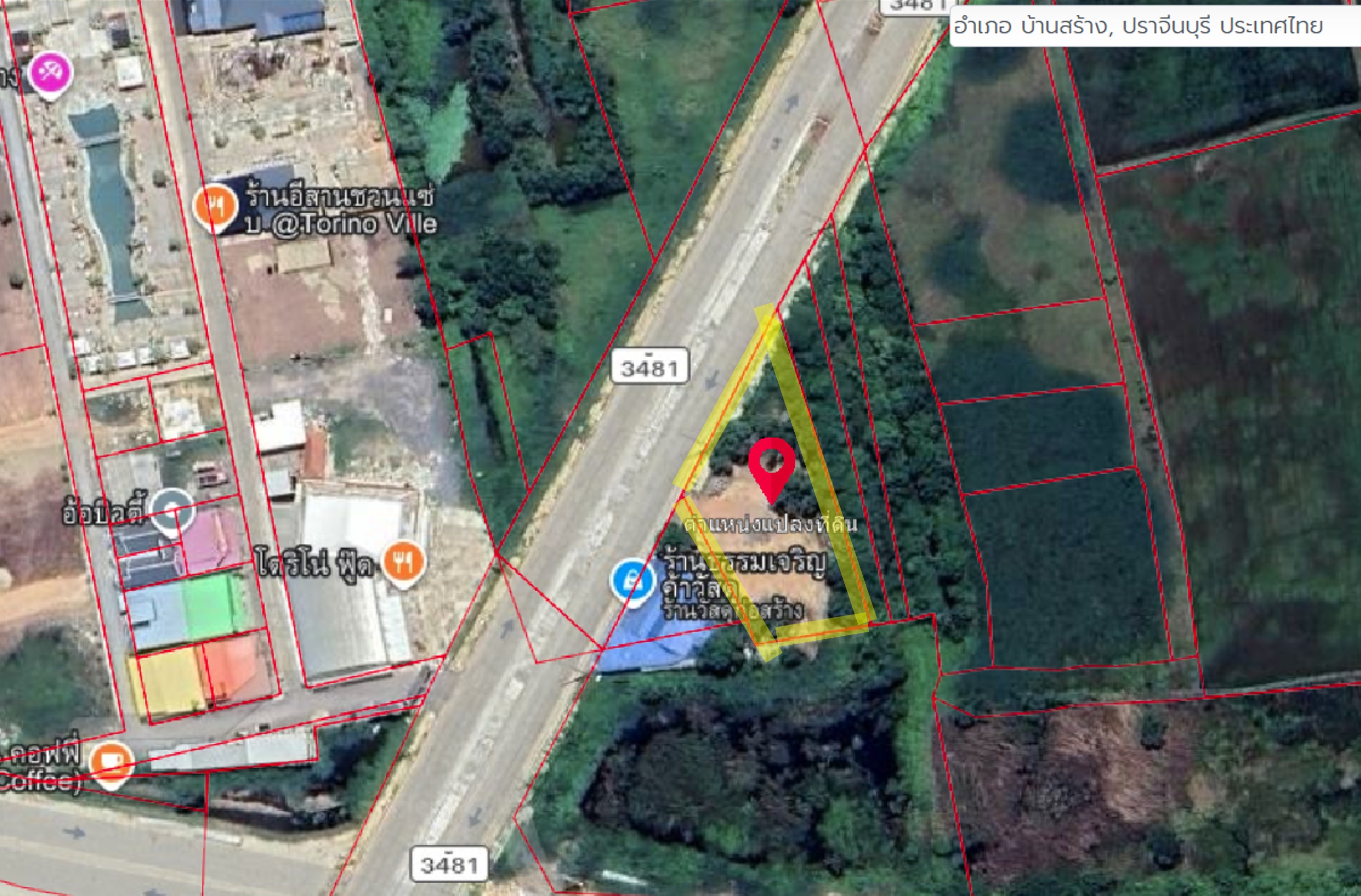
A system that helps analyze potential investment locations using spatial analysis factors, starting from gathering land parcel data from real estate agents into an online map format and analyzing investment feasibility based on business factors and spatial data. It facilitates tracking the status of each land parcel transaction and provides real-time access to information, including presenting data to executives in the form of an Interactive Dashboard for more effective decision-making than ever before.
Land Analysis is an application equipped with analytical tools to find land parcels with potential investment locations by using spatial data alongside investors' business data, calculating weighted scores to aid in selecting promising areas from a large dataset of land parcels. Essential to land analysis is spatial data reflecting real conditions, allowing investors to compare surrounding environments and differences between land parcels, enhancing decision-making potential with reliable data amidst current competitive and economic conditions, including the following data: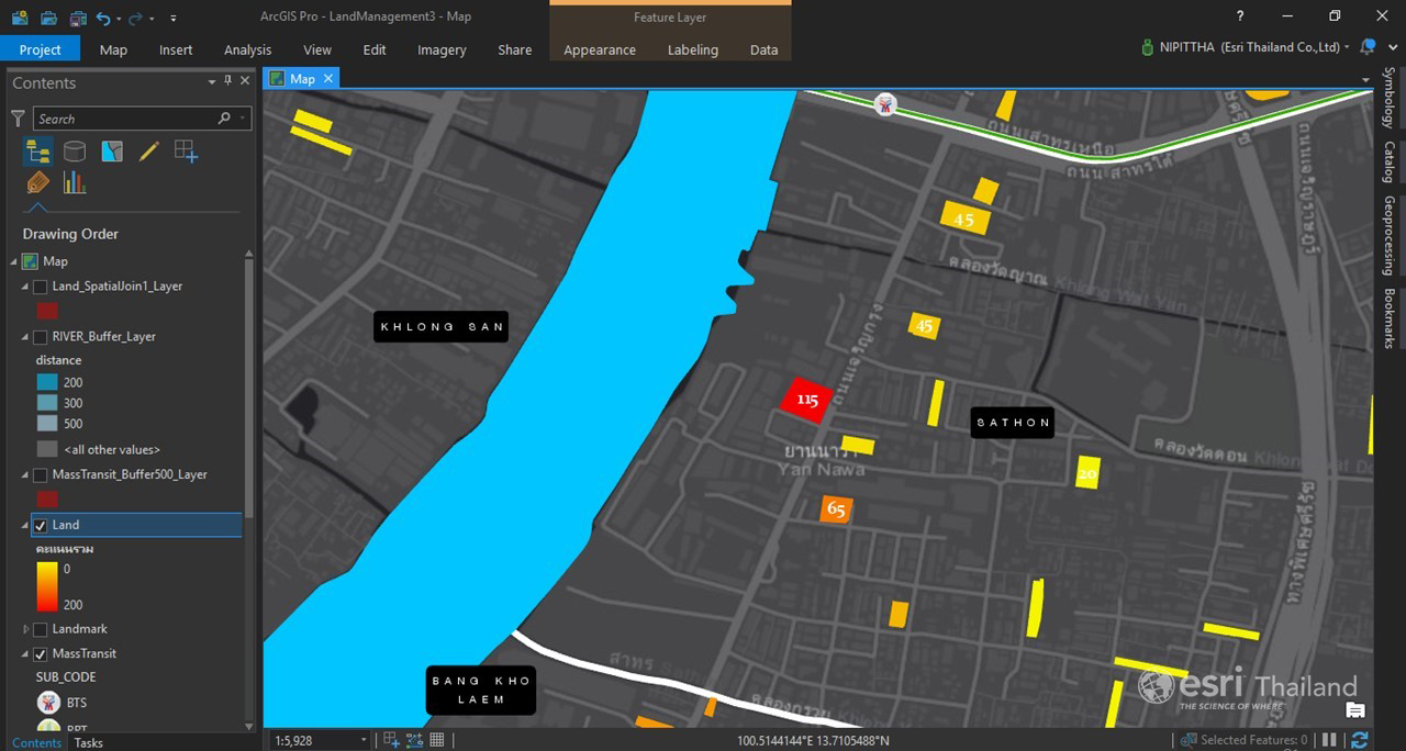
- Road data and details, including types of main and secondary roads, road width, and number of lanes
- Water source data, including rivers and canals
- Data on important locations, such as shopping malls, office buildings, convenience stores, all types of train stations, expressway entrances and exits, educational institutions, etc.
- Current and future railway route data
- City planning data, including land use types
- Expropriation line data
- Future construction data, such as villages, shopping malls, restaurants, etc.
- Demographic data in the area, categorized by age, gender, income, and purchasing power by product type
Additionally, there are systems to support various processes in real estate business development, including:
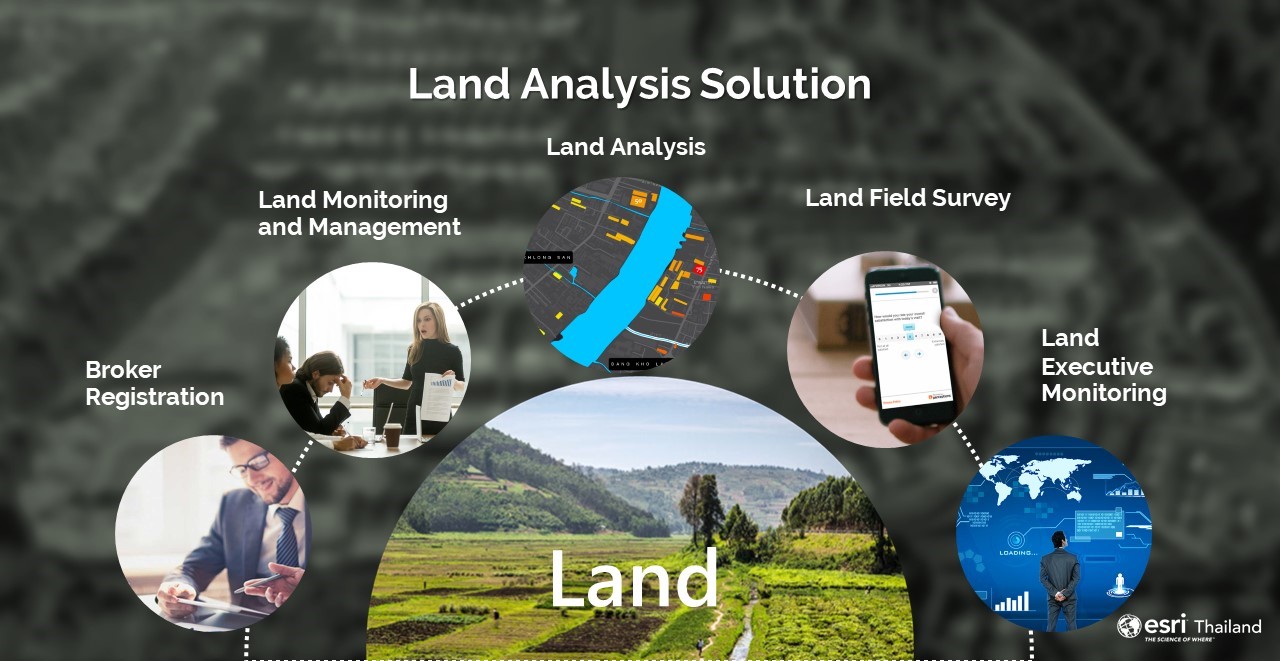
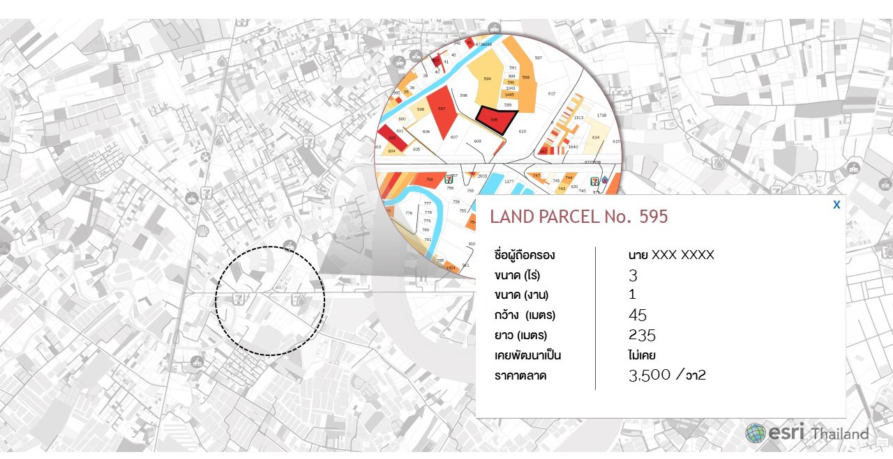
- Land Registration is a web application for importing land parcel data from previous paper records into a digital format, allowing users to draw land parcels and input details such as contact address, land size, asking price, and various title deed files, facilitating data storage and enabling real-time use in other processes.
- Monitoring and Management is a web application for viewing land parcel data registered by agents or officials through the Land Registration system in real-time, allowing status updates, data modifications, and basic spatial data analysis.
- Land Field Survey is an application for field data collection, whether for land parcel data or market information, with additional details that can be used for immediate analysis and access. It is compatible with mobile devices on both iOS and Android as a Native Application. It also includes functions for drawing and editing land parcel shapes, capturing coordinates, taking photos, and attaching documents on-site. If field data collection occurs in areas without internet signal, it can operate offline.
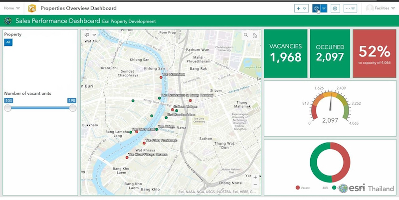
- Land Executive Monitoring is an application summarizing land parcel data in a Dashboard format, working with interactive maps, graphs, and tables, allowing users to design settings for various reporting formats, including total land parcels, parcel status, location, asking price, parcel size, and overall summaries by area to view the number of land parcels and total prices. In the future, if users wish to change the display format, they can adjust the settings further.
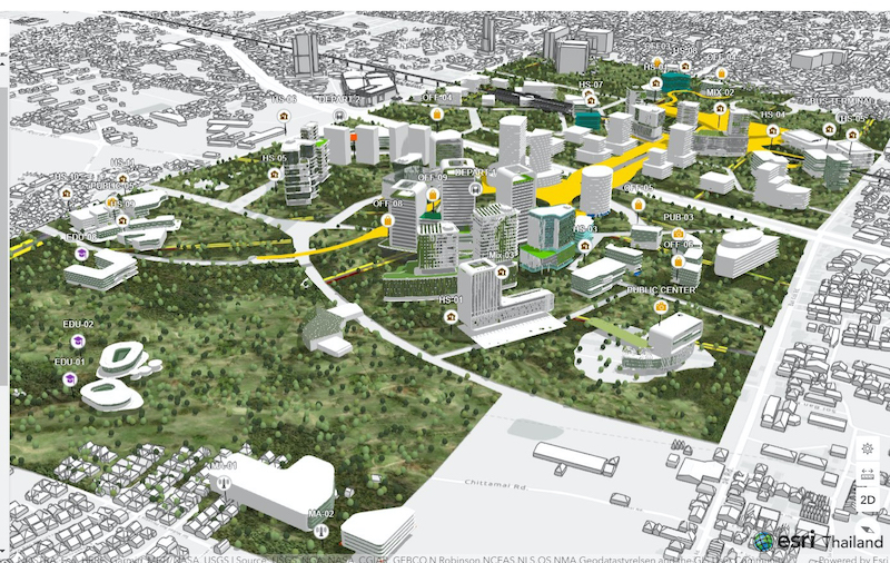
In addition to the land management system, ArcGIS also provides tools for simulating project sales areas in 3D under urban planning legal requirements (3D Building Typology Simulation), which helps reduce the time needed to calculate building sale areas. It can also utilize 3D building models from simulations as guidelines for building design alongside CAD technology and BIM (GIS Integrate with CAD and BIM) for comprehensive management of both external and internal building spaces, with ready-to-use applications from ArcGIS (Space and Property Management)
Let our technology empower you to see what others cannot “See What Others Can’t”
For more info www.esrith.com
Call: 02-678-0212
Email: [email protected]
Thanks for the information from www.arcgis.com