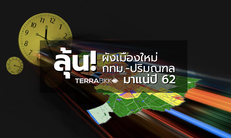
Anticipating the New Urban Plan for Bangkok and Surrounding Areas in 2019
In Klongtoey, the urban planning department has revealed that the draft of the new Bangkok and surrounding areas urban planning act is progressing. This comes as community areas and construction zones continue to expand, focusing on optimizing land use to promote urban development. It is expected to be enforced by the end of 2019.
Mr. Montree Sakmuang, an advisor on urban planning from the Department of Public Works and Town & Country Planning, Ministry of Interior, stated during the seminar "Bangkok Quadrant: Dissecting the New Urban Plan to Transform Bangkok into a Global Metropolis" that the current community and construction areas in Bangkok and its vicinity are showing a trend of significant growth, covering almost all of Bangkok and extending beyond the Kanchanaphisek Ring Road along major transportation routes. The construction area is expected to expand by over 2,000 square kilometers, housing approximately 16.7 million people, with projections estimating the population will rise to 19.8 million in the next 20 years.
Regarding land use trends in Bangkok and its surroundings, 50% of the area is agricultural, primarily located in Nakhon Pathom and Nonthaburi. Additionally, there has been encroachment into suburban agricultural areas, converting them into densely populated residential zones, particularly in Nonthaburi and Pathum Thani. The demand for urban and industrial land is expected to increase in line with population growth, infrastructure development, and economic activities. The new urban planning legislation for Bangkok and its surrounding areas is anticipated to be completed by the end of this year and will move into the consideration phase.
Mr. Sakchai Boonma, director of the Bangkok Urban Planning Office, mentioned that the new draft of the Bangkok and surrounding areas urban planning act is expected to be enforced by the end of 2019. This new urban plan will emphasize optimizing land use to promote urban development, particularly around mass transit stations. It aims to develop the Rama 9 area into a new CBD, adjust land use ratios to encourage urban development, and extend the development radius around electric train stations from 500 meters to 800-1,000 meters, which is currently under review.
New urban planning measures will include regulations for large-scale development projects. There are also plans to create specific area development plans, with one of three pilot projects under the master plan focusing on the conservation and revitalization of the Kadi Jin-Klong San area. The other two projects include the construction of a waterway and bicycle tourism information center under the Phathom Ratchanusorn Bridge and the improvement of the landscape along the Chao Phraya River bridge near the Phra Pok Klao Bridge. Recently, the private sector has participated in urban development, such as in the Ratchaprasong model, Silom area, and Bang Kapi innovation district by enhancing the landscape.
TerraBKK has highlighted key points from the Bangkok urban plan discussed at the "Bangkok Quadrant: Dissecting the New Urban Plan to Transform Bangkok into a Global Metropolis" seminar, showcasing changes from the previous urban plan.
- The draft land use plan for the upcoming Bangkok urban plan in 2019 aims to create a compact central business district (CBD) with inner city areas designated as Sub-CBDs, including Thonburi, Ari-Jatujak, and Ratchada-Rama 9. To accommodate urban expansion, densely populated residential areas (indicated in dark blue) will extend in three main directions: Jatujak (north), Rama 9-Ramkhamhaeng (east), and Phetkasem (west).
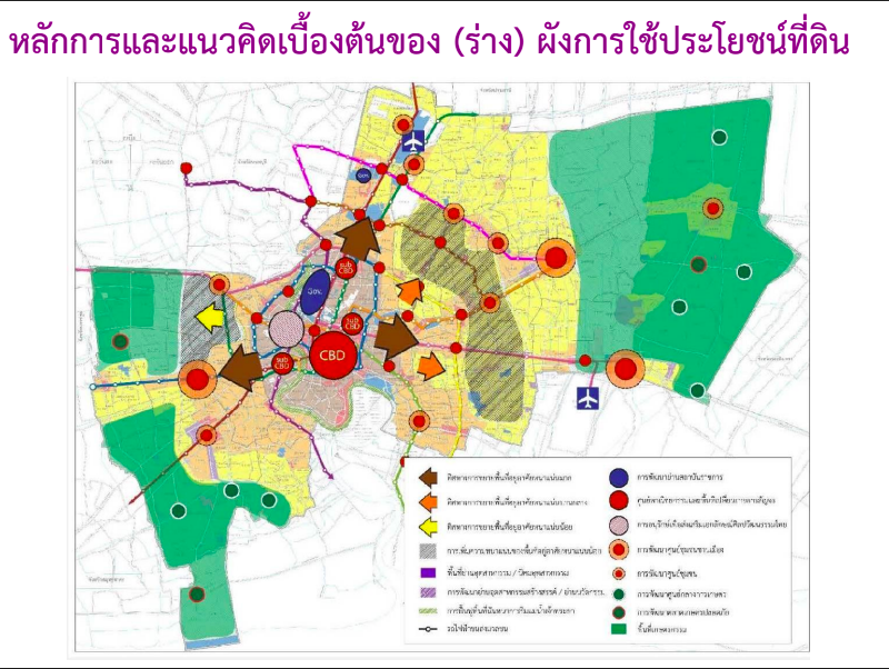
- The color scheme or land use regulations in inner city areas served by the electric train will be adjusted to enhance development potential. For instance, the Asoke-Klongtoey area will shift from high-density residential (brown zones 9 and 10) to commercial areas (zone 7) to facilitate the development of large buildings.
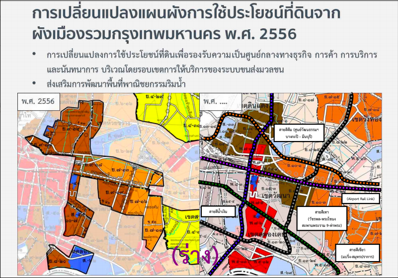
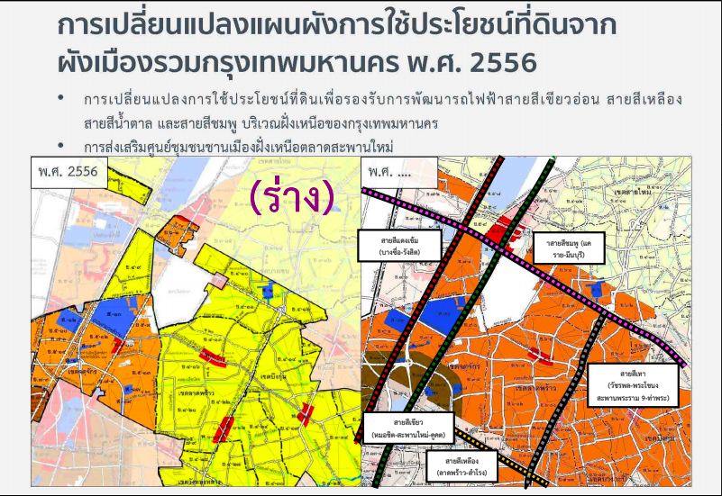
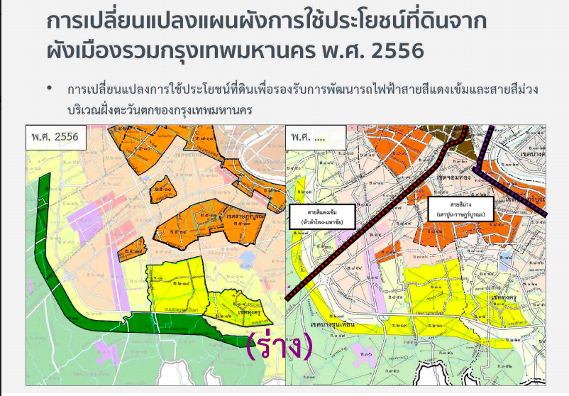
- Adjustments will be made to the color scheme in outer city areas to accommodate urban expansion due to access to extended electric train lines, particularly the light green, yellow, brown, and pink lines.
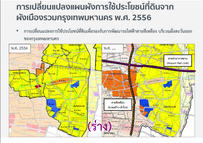
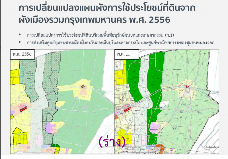
- Floodway areas in the east, previously designated as rural and agricultural conservation areas (zone 1), will be converted to agricultural land, allowing for residential development.
- The color scheme will change from rural and agricultural conservation areas (zone 2) in the western suburban area to low-density residential areas to accommodate residential expansion in the suburbs.
- The color scheme in suburban areas will be adjusted to low-density residential to support housing expansion in suburban areas alongside the red and purple electric train lines.
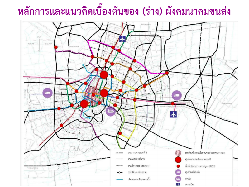
- Transport connections will be designed to be more balanced and fluid, ensuring comprehensive access to public transport throughout Bangkok.
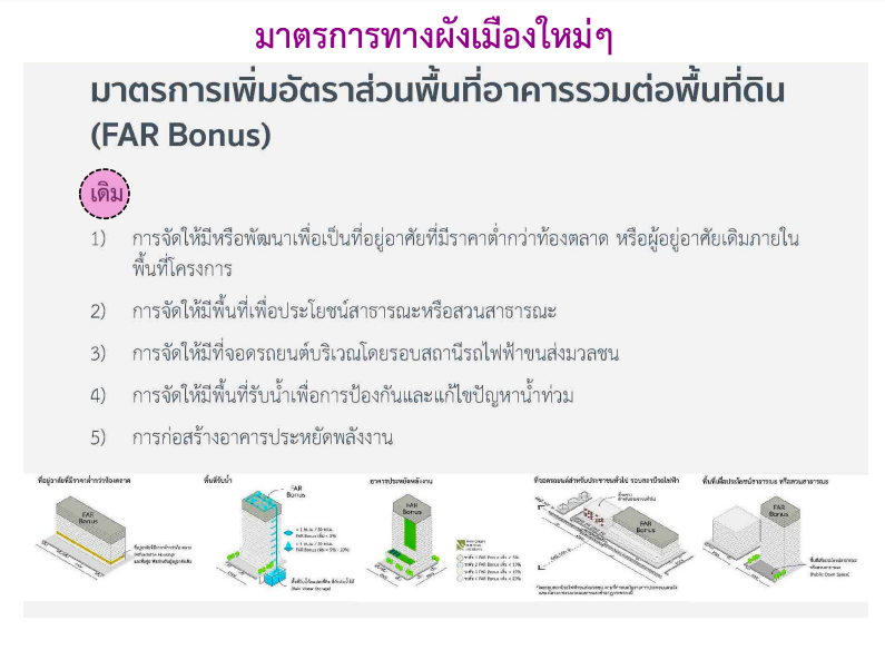
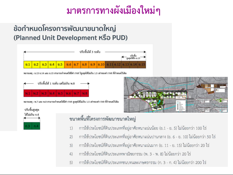
New incentive measures will be introduced, such as regulations for large-scale development projects (Planned Unit Development), adjusting land use regulations from zones 1-12 to zones 1-15.
Key points of interest that cannot be overlooked include the ability to develop large-scale projects in low-density residential areas, which was previously not allowed, under specified conditions.
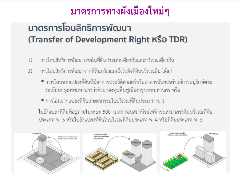
Development rights transfer measures (TDR) or air rights transfer.
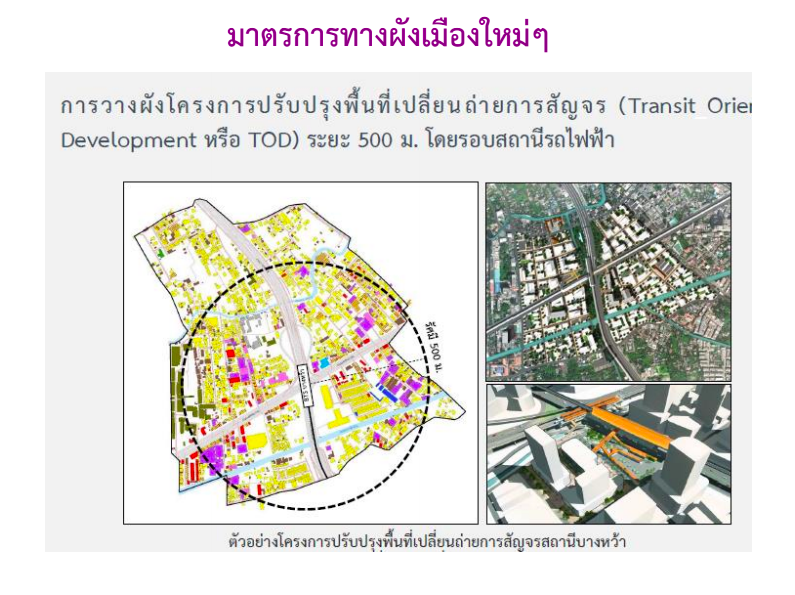
Planning the area around electric train stations to serve as transfer points based on the Transit-Oriented Development (TOD) concept within a 500-meter radius of the stations.
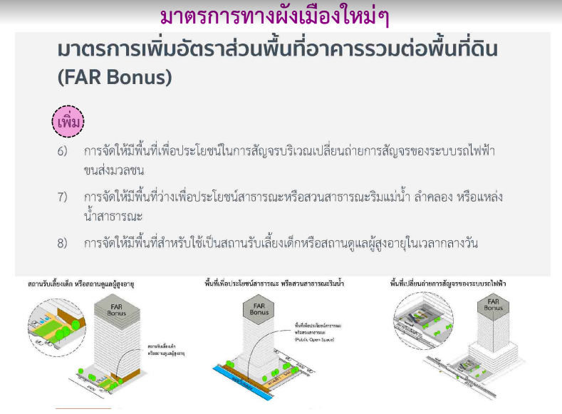
Providing FAR Bonus under new conditions