In 6 Years, Chiang Mai Will Have a Skytrain
The skytrain is coming, folks! Residents of Chiang Mai no longer have to wait in anticipation, as the public transportation development master plan for Chiang Mai has recently been approved for construction! The director of the Office of Transport and Traffic Policy and Planning (OTP) has authorized the Mass Rapid Transit Authority of Thailand (MRTA) to be responsible for sourcing private investment in a Public-Private Partnership (PPP) for the light rail system (BRT) to address traffic issues. The provinces approved for this project include Chiang Mai, Phuket, and Nakhon Ratchasima, with an estimated investment budget of approximately 86 billion baht for Chiang Mai's light rail.
Chiang Mai Skytrain Routes
The initial study for the public transportation master plan in Chiang Mai has proposed two alternative skytrain routes:
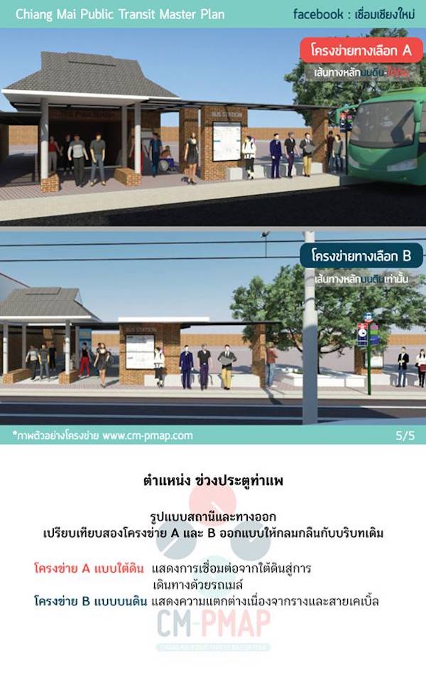
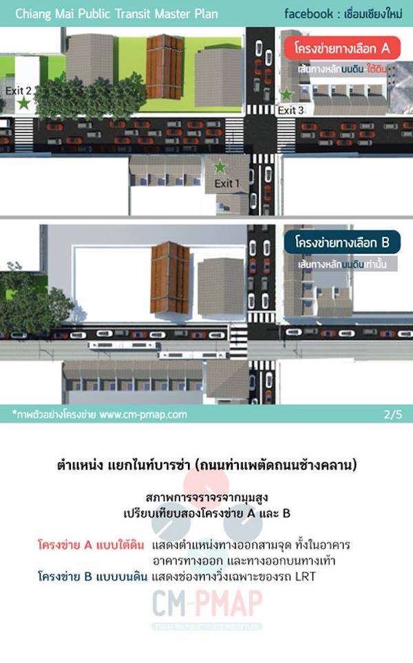
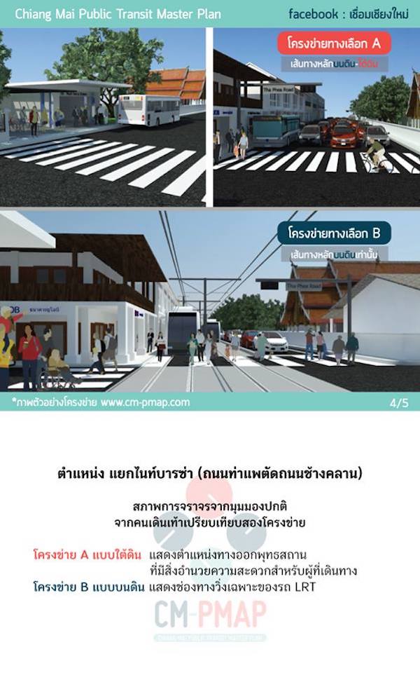
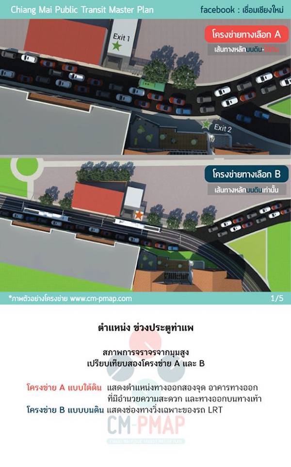
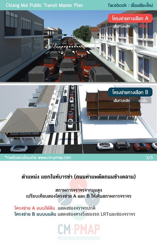
Option A: This option combines above-ground and underground routes, covering a total distance of 35 km with three main lines: the red line (12 km), the green line (12 km), and the blue line (11 km). The construction is expected to take about 6 years.
Option B: This option utilizes entirely above-ground routes, covering a total distance of 40.57 km, with three main lines: the red line (15.65 km), the green line (11.11 km), and the blue line (13.81 km). The construction is expected to take about 3 years.
Both options feature three main routes that will serve as pilot and primary routes for initial implementation, along with additional routes for public transport in the surrounding areas, totaling 9 routes:
Pink Line: Starts at Mae Rim district, connects with the red line at Nakornping Hospital, and connects with the green line at Ruam Chok intersection, ending at Mae Khao intersection.
Dark Green Line: Starts at Mae Jo University, connects with the green line at Ruam Chok intersection as the endpoint.
Orange Line: Starts at Mae Jo University, connects with the green line at Ruam Chok intersection as the endpoint.
Gray Line: Starts at Doi Saket district, connects with the orange line at Mae Khao intersection, and connects with the green line at Central Festival as the endpoint.
Purple Line: Starts at Hang Dong district, connects with the red line at Mae Hia intersection, and connects with the blue line at Promenada intersection as the endpoint.
Yellow Line: A secondary line connecting with other public transport networks.
Black and White Line: A suburban rail line that will run along the existing railway tracks, ending at Chiang Mai Railway Station.
Option A is the preferred route for Chiang Mai residents.
The approved construction option is Option A, which combines above-ground and underground routes, featuring three main lines: the red line, the blue line, and the green line.

Red Line
This north-south route starts from Nakornping Hospital and ends at Big C Hang Dong. TerraBKK views this route as covering important locations for Chiang Mai residents traveling from outside the city.
Blue Line
This west-east route starts from Chiang Mai Zoo and ends at Promenada intersection. TerraBKK sees this route as accommodating tourist travel, as it passes by many key attractions in Chiang Mai.
Green Line
This north-south route starts from Ruam Chok intersection near Mae Jo University and ends at Chiang Mai Airport. TerraBKK views this route as capturing nearly all important public facilities and infrastructure in Chiang Mai, such as schools, hospitals, markets, transport offices, and the airport.

Once the three light rail routes are completed and operational, they will provide extensive access to key locations in Chiang Mai, which is believed to significantly alleviate traffic problems in the city, as these routes are frequently used by Chiang Mai residents. - เทอร์ร่า บีเคเค
Article by: TerraBKK Investment Tips
TerraBKK: Find good, valuable, and affordable homes