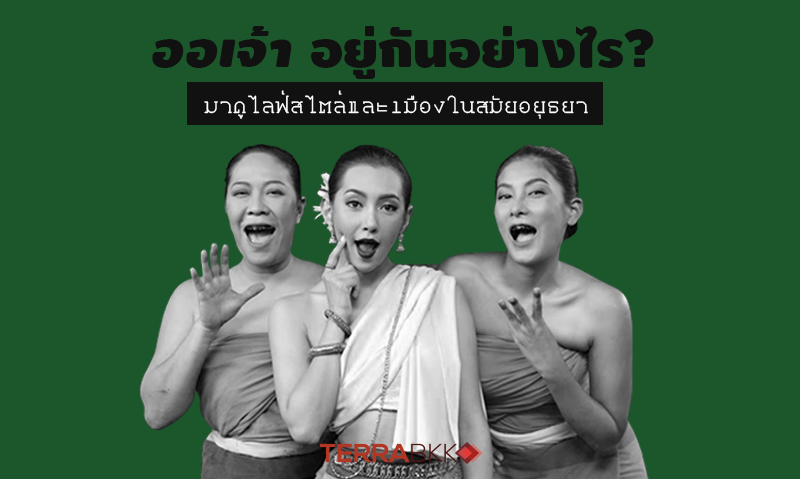
How Did People Live? Exploring the Lifestyle and City of Ayutthaya
Rumor has it that the home of Phra Khun Sunthorn Thewa is located near Wat Chaiwatthanaram. Whether ordering a pan or buying a monk's robe to offer to the monks at the market, it takes little time to travel by boat. This indicates that Phra Khun Sunthorn Thewa's house must be situated in the area known as the "city center" of Ayutthaya. But do you all know what the actual context of "Yudia" or Ayutthaya was like back then? Where was the center of the city?
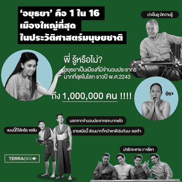
‘Ayutthaya’ is one of the 16 largest cities in human history.
Historical studies and data collection from Western nations have mentioned “Ayutthaya” or “Yudia”, as referred to by Westerners at that time, in comparative studies of prosperity between New York City in the 20th century, London in the 1900s, Constantinople 600 years before Christ, and Jericho 7,000 years before Christ. The name Ayutthaya appeared as the most populous city in the world, with 1,000,000 people around the year 1700, growing threefold from the year 1600, approximately 100 years during the reign of King Ekkathat to King Phetracha, which coincided with the time when Mae Karaked and Phra Khun Sunthorn Thewa lived, marking a period of near-peak growth in Ayutthaya during the reign of King Narai the Great (1656-1688).
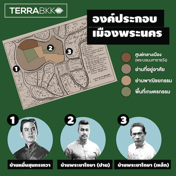
Components of the City of Phra Nakhon
The center of Ayutthaya, or what could be called the CBD at that time, was the island of Krung Phra Nakhon Si Ayutthaya, surrounded by three rivers: the Pa Sak River (to the north), the Chao Phraya River (to the west and south), and the Lopburi River (to the east). The shape of Ayutthaya as an island was well-suited because King U Thong dug a moat connecting the three rivers to prepare for warfare. As times changed and maritime trade with foreign countries increased, Ayutthaya became a trading hub with foreigners due to its geographical advantages. Westerners at that time referred to Ayutthaya as the “Venice of the East”, and the geographical layout of Ayutthaya served as a model for the Rattanakosin Island of present-day Bangkok.
The island of Phra Nakhon was surrounded by walls and fortifications. It can be seen that whenever Phra Khun Sunthorn Thewa wanted to go somewhere, he would instruct his boatman to row towards a specific fort gate, similar to how main roads function today.
In the central area of the city, the Grand Palace was located in the northern-central part. It included the royal palace on the east, the residence of the Uparaja to the west, and the royal family’s quarters, along with wooden pavilions for various royal duties.
To the south of the Grand Palace was the residential area for nobles and ministers, clustered along the roads and riverbanks, including the houses of Phra Ya Kosa (Pan) and Khun Ruang.
The residence of Phra Ya Horathibodi, the father of Phra Khun Sunthorn Thewa, was located outside the island of Phra Nakhon to the west near Khlong Kha Lab, just one canal away from Wat Chaiwatthanaram.
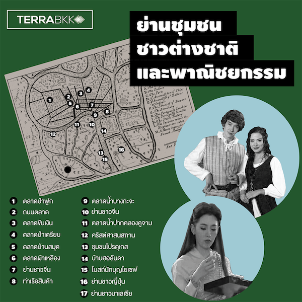
Community Areas for Foreigners and Commerce
The foreign communities mostly clustered outside the city to the south according to their ethnic groups, such as the Japanese village, Portuguese village, Dutch village, and Indian village, due to proximity to the foreign trade port. There are also records of a street named China Street in that area according to the Plan de Ville de Siam. Additionally, it was noted that during the reign of King Narai, there were over 20 different nationalities.
For the shopping area where Mae Karaked went to shop at the yellow fabric market, the pencil house market, or to order a pan, it was located at the intersection of the main roads of the city, which is the central road coming from the Grand Palace and the east-west road, a layout that still exists today. Besides the markets seen in the dramas, there were also floating markets and other markets in the city of Ayutthaya, totaling over 70.
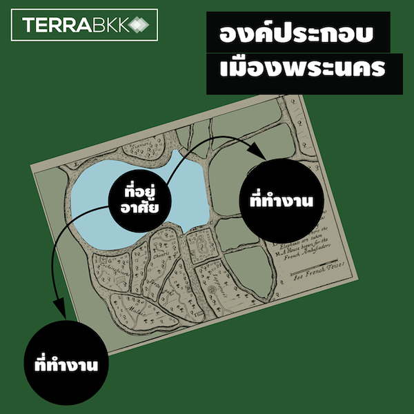
Living in the City but Working Outside
Part of the chronicles of Phan Chanthanuamart during the reign of King Naresuan states that the enemy set up military camps outside the area to prevent the people of Phra Nakhon from farming. This implies that people at that time had homes within the city but worked outside, similar to the Ayutthaya period when they would go to Thung Pra Ched or Thung Hantra for agriculture, but only during the rice planting and harvesting seasons. At that time, there was no rice export; it was only sent as tribute to the Qin Shi Huang of China. Agriculture was not the primary occupation of the people of Ayutthaya.
As seen in dramas, the villagers of Ayutthaya had various occupations, such as pottery, blacksmithing, knife-making, mat weaving, carpentry, and vegetable selling. Moreover, there was a system of slavery at that time, which meant that labor in Ayutthaya was grouped and did not have clearly defined individual occupations.
In summary, the urban layout of Ayutthaya at that time had the city center as the location of government (the Grand Palace), the residences of the upper class, and commerce, while the sources of work were located outside the city. This contrasts with the present day, where residences are outside the city and the central work sources are in the city.
As you may have seen in the dramas, the economic, political, and diplomatic conditions during the reign of King Narai began to become more global, leading to maritime trade with foreigners and the exchange of knowledge and new technologies, including the beginning of rice exports, which has become a major export product of Thailand today. “Ayutthaya” or “Yudia” is thus remembered by Westerners as once being the most prosperous and magnificent kingdom in the world.
References:
http://thainationhistory.blogspot.com
Article by: TerraBKK Investment Tips
TerraBKK Finding Good Homes, Value for Money, Affordable Prices