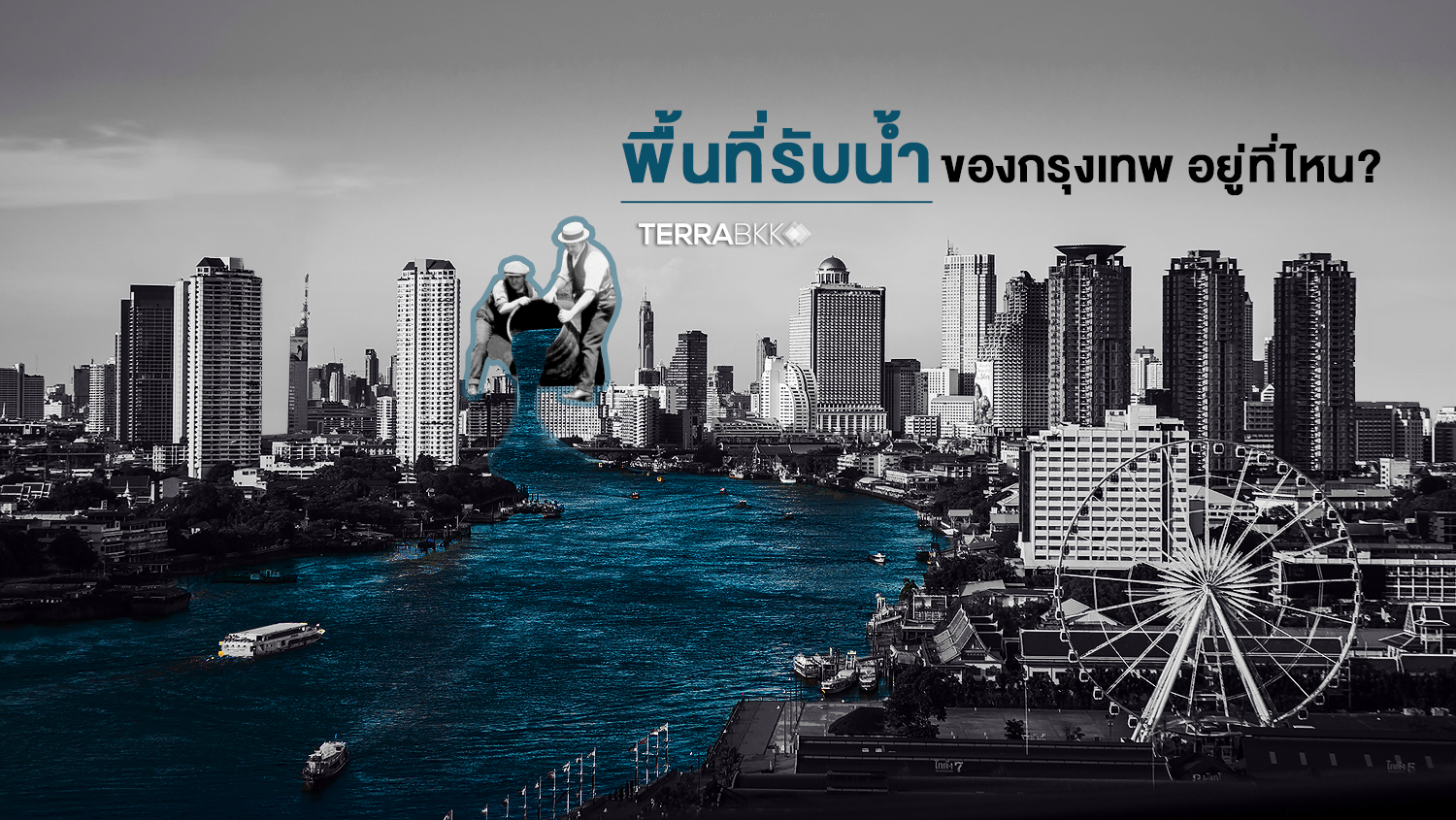
Where are the Water Retention Areas in Bangkok?
In fact, Thailand has been organizing and regulating land use since the reign of King Rama V (the Department of Public Works was first established in 1890) and this has continued to the present day. The latest urban planning regulations controlling land use in Bangkok is the "Bangkok Master Plan 2013". Most of us are familiar with the zoning colors that classify land use, such as red zones for commercial land and brown zones for high-density residential areas. However, there is much more information that often goes unnoticed, such as transportation and logistics plans, public utility project plans like canal excavation and drainage tunnel projects, as well as open space plans that have become "water retention areas" as well.
TerraBKK is discussing the "Open Space Plan as per the Ministerial Regulation" which defines the use of open spaces according to six objectives, referred to as L.1 - L.6. Here, L.1. refers to open spaces for recreation and environmental quality maintenance, L.2. for maintaining environmental quality along roads, L.3 for maintaining environmental quality along rivers and canals, and L.6 for conserving and restoring coastal environments, including our star of the article, the "water retention areas" designed for drainage and flood prevention.
Drainage Areas
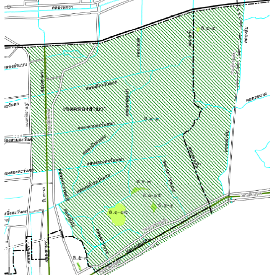
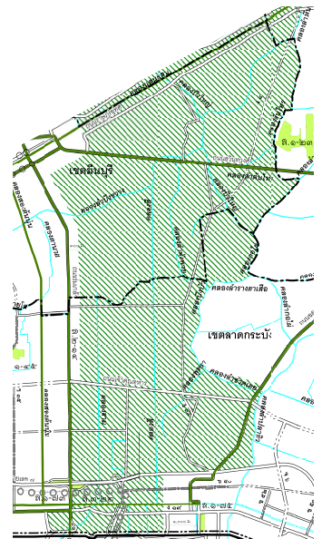
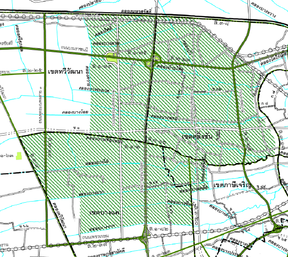
The "water retention areas" classified as L.4. will be open spaces designated as "white with green diagonal stripes" to preserve natural drainage conditions. These areas are divided into two sides of Bangkok: the eastern side includes parts of Khlong Sam Wa, Min Buri, and Lat Krabang, while the western side includes parts of Taling Chan, Thawi Watthana, Bang Khae, and Phasi Charoen.
Flood Prevention Water Retention Areas
The "water retention areas" classified as L.5. are open spaces designated as "light green with green diagonal stripes" for water retention to prevent flooding. These areas are scattered throughout the eastern side of the Chao Phraya River and are also known as the "Monkey Cheek Project", a brilliant initiative by King Rama IX to address flooding issues in eastern Bangkok since 1980. The "water retention areas" include both private monkey cheeks located in private areas or housing estates and public monkey cheeks managed by the Bangkok Metropolitan Administration and government agencies.
Currently, there are 25 operational water retention areas that can hold approximately 13.04 million cubic meters, mostly located in central Bangkok such as Pathum Wan, Khlong Toei, Phaya Thai, Bang Kapi, and Prawet. Additionally, there are 2 water retention areas under construction that can hold an additional 316,700 cubic meters, located on Ramkhamhaeng Road in the Saphan Sung district, namely the water retention pond of the Samakorn Village and the water park on Seri Thai from Klong Rha to Klong Khu. Furthermore, there are about 12 additional water retention areas planned to be developed in the outskirts of Bangkok, such as Sai Mai and Khlong Sam, which are expected to hold an additional 6.18 million cubic meters.


Although the majority of the water retention areas are located on the eastern side due to high population density, there are also the "Mahachai-Sanam Chai" monkey cheek projects on the western side to help drain floodwaters in the upper western areas. In conclusion, TerraBKK encourages the relevant agencies to work together in implementing the "Monkey Cheek Project" as envisioned by King Rama IX to alleviate flooding issues and improve the quality of life for the people of Bangkok. --- TerraBKK
Images and references: City Planning Department Department of Drainage
Article by: TerraBKK Investment Tips
TerraBKK Find Good, Affordable Homes